
CCO extreme water level assessment and comparison with the Environment Agency Coastal Flood Boundary Dataset (2018)
Minor project 2025-2026 \ Dr Thomas Dhoop and Elizabeth Warwick-Champion, Channel Coast Observatory. £3,000 SCOPAC contribution.
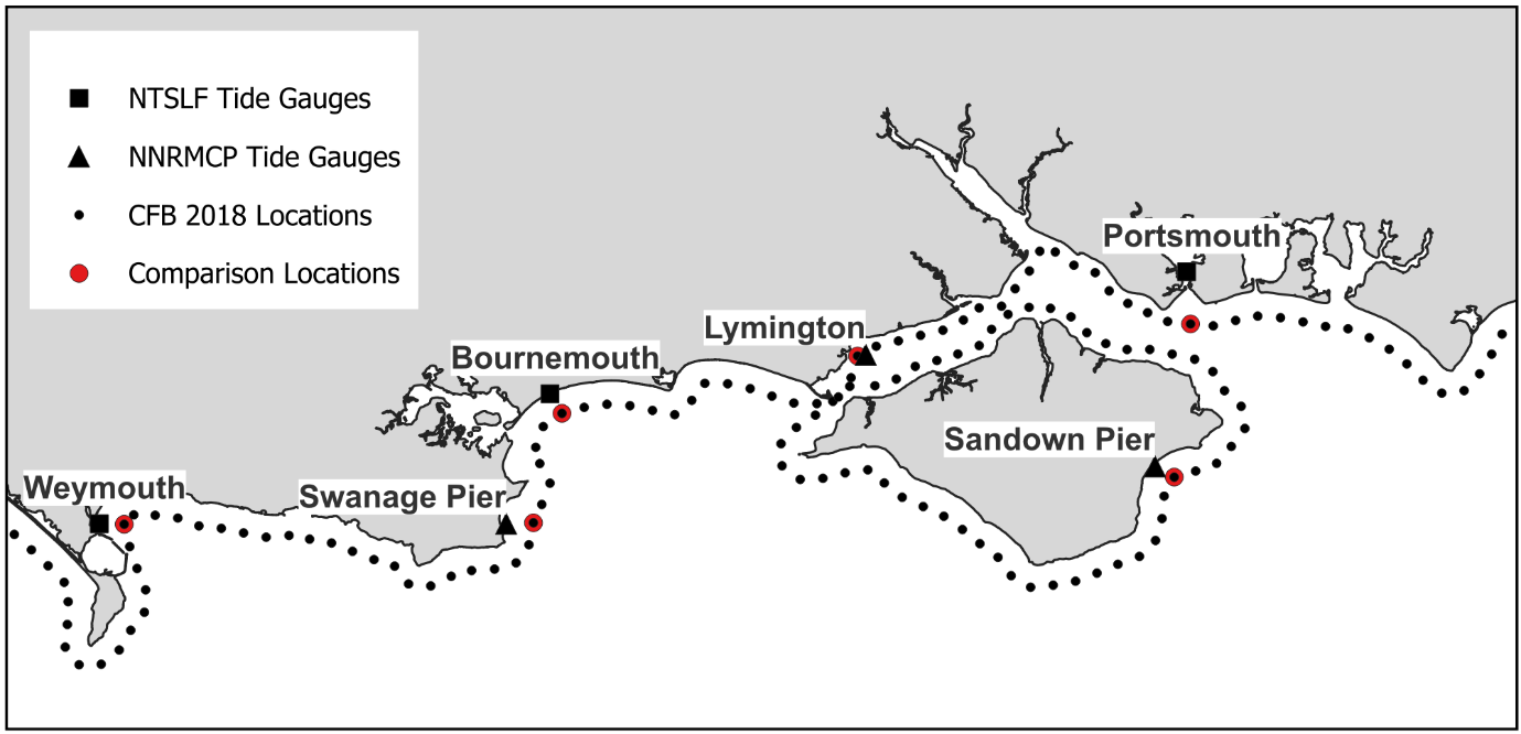
Figure 1 The tide gauge sites and CFB locations compared in the assessment.
Elizabeth Warwick-Champion and Dr Thomas Dhoop from the Channel Coastal Observatory (CCO) write,
“Accurate estimation of extreme sea levels is crucial for effective coastal management and flood risk assessment. The Coastal Flood Boundary (CFB) dataset, generated by the Environment Agency (EA) in 2018, has been a foundational resource for practitioners in modelling coastal flood risks across the UK. This dataset is an update to a previous version issued in 2011 and provides probabilistic extreme sea level estimates that inform the design and implementation of flood defences and coastal infrastructure. Accurate extreme sea level estimates are critical to project cost and safety. Over-estimates lead to over-designed, expensive defences, while under-estimates increase the risk of overtopping or failure during a scheme’s lifetime.
“Coastal practitioners have recently encountered discrepancies when utilizing the CFB dataset for modelling exercises. Specifically, models have been run with unrealistically low ‘extreme’ water levels derived from the CFB, raising concerns about the dataset’s current validity. These concerns are particularly pressing in light of ongoing coastal strategies within the SCOPAC region, in particular at Christchurch Bay and Harbour, and between Hurst and Lymington, as well as the Flood and Coastal Erosion Risk Management (FCERM) schemes in the East Solent regions of Hayling Island and Selsey Bill.
“Extensive tidal data is available from various open coast tide gauges managed by the EA (National Tide and Sea Level Facility, NTSLF) and the National Network of Regional Coastal Monitoring Programmes (NNRCMP). This wealth of observational data presents an opportunity to assess the extreme sea level estimates provided by the CFB dataset. By comparing the CFB predictions with actual measured water levels, the accuracy of the assigned probabilities for extreme events and their suitability for current and future coastal projects was assessed.”

Assessment of the EA Coastal Flood Boundary Dataset (2018) in the SCOPAC region against observed tide-gauge records
E. Warwick-Champion & T. Dhoop, July 2025
Download the report (20pp PDF)
CCO review of EA CFB (2018) extremes webinar
December 2025, presented by Dr Thomas Dhoop and Elizabeth Warwick-Champion from the CCO, with next steps for updating the EA CFB dataset presented by Tim Hunt and Jenny Sansom from the EA, available at:
- SCG and SCOPAC Research Webinar | CCO review of EA CFB (2018) extremes – the webinar recording is restricted by password to attendees and members.